
Katahdin: Day 96*
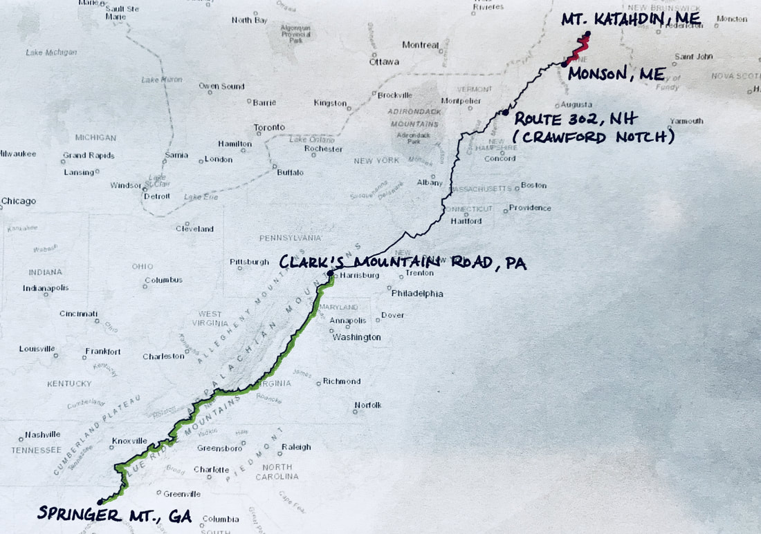
August 8, 2017. Mom carefully packs me a sushi dinner and drops me off at the Appalachian Trail Lodge in Millinocket, ME. Tomorrow, I will summit Katahdin and continue my thru-hike, making my way back to Clark’s Mountain Road, PA.
The bunk room seems stuffy with the smell of unwashed hikers’ laundry. I am a bundle of nerves. My hands tremble just thinking about hiking above tree line. My mind races endlessly with potentially fatal mistakes: a slip, a fall, a bolt of lightning –
I am scared. No, terrified. Scared my feet will fall apart. Terrified of the terrain. The weather. The heights.
The heights. I once read that most people fear falling, not heights. I’m not convinced there is a difference for me: I am afraid that I-will-fall-and-the-height-of-the-fall-will-kill-me.
That night, I manage to eat only four pieces of sushi. The sounds of Millinocket rise through my windowsill. Lovers quarreling. Cars screeching. A man walking drunkenly down the road, singing loudly to himself. In the end, I fall asleep to the rhythmic pounding of my heart.
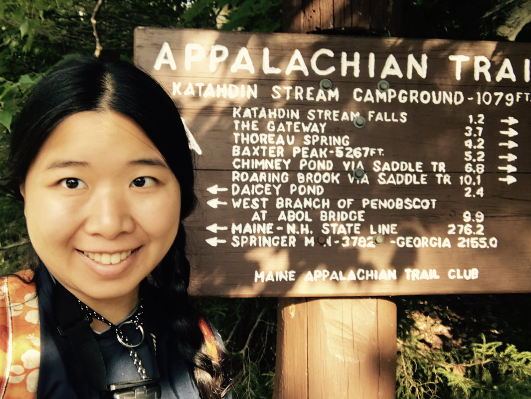
August 9, 2017. I get into the Baxter State Park shuttle in a daze. There are five hikers heading into the park to summit today. Josh, our driver, asks if anyone has a camping pass. I hand him my Katahdin Stream Campground reservation.
By the time we get to the park, a 0.5 mile long line of cars awaits. Josh pulls out of the line and drives up the narrow gravel road, bypassing the other cars.
“Is that the no-pass line?” he asks another driver.
It is not.
With no room to turn around, he attempts to squeeze in front of a truck.
“Do you mind if we get in here?” one of the hikers asks.
“F— yeah!” the driver shouts.
“We’ve got a reservation.”
“So does everybody in this line!”
“I’m sorry,” Josh yells, rolling down his window. “I feel like a dick for doing this. I thought this was the no-pass line.”
The driver relents, and we get to the ranger station by 7:30 am.
I check in, leave my pack in the waiting area, and grab a daypack from a box. The daypacks reek from the sweat of hundreds -maybe thousands - of thru-hikers, but I’d rather carry a daypack than my full pack up Katahdin.
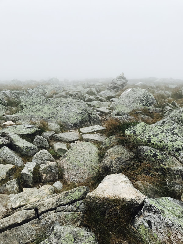
8:00 am. I begin hiking up the 5.2 mile Hunt Trail, which Overlaps the Appalachian Trail, up Katahdin. I race through the first mile, which consists of flat, forested dirt paths. The terrain becomes rockier, but not overly outrageous, in the second mile. I complete the first two miles in less than an hour.
Then, I reach tree line.
Huge boulders face me. I scramble up, using my hands, knees, elbows, and bum to lift myself. The rocks seem endless. An iron rung is drilled into one boulder. I haul myself up onto a cliff maybe 2-3 feet wide. I move slowly, my heart beating furiously as I contemplate the view so, so far below.
This is NOT fun, I think.
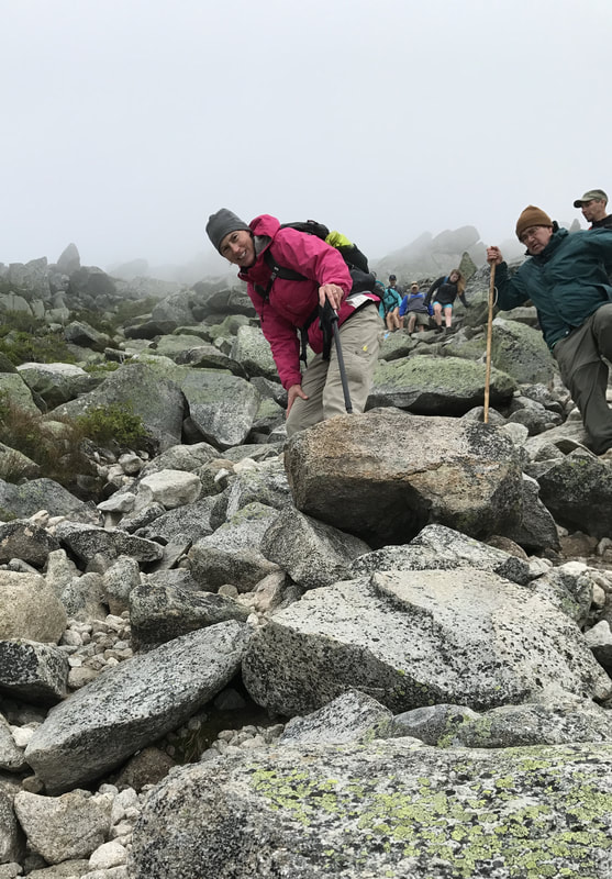
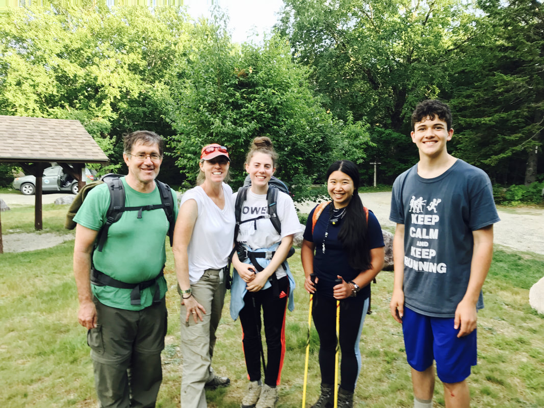
I cross paths with a family of four: Phil, a middle-aged man with curly hair, glasses, and a single walking stick, David, his son, tall and athletic with brown hair, Anne, a fit middle-aged woman with a bright pink jacket, and Emma, her daughter, who wears her hair in a bun.
The trail runs straight up a 4-foot boulder. A 5-inch piece of iron is drilled into the stone, maybe 3 feet off the ground. I reach up, trying and failing to find a handhold. I can see one a few inches out of my reach. David scampers up and offers his hand.
“Thanks,” I say.
He helps the rest of his family up. They continue on.
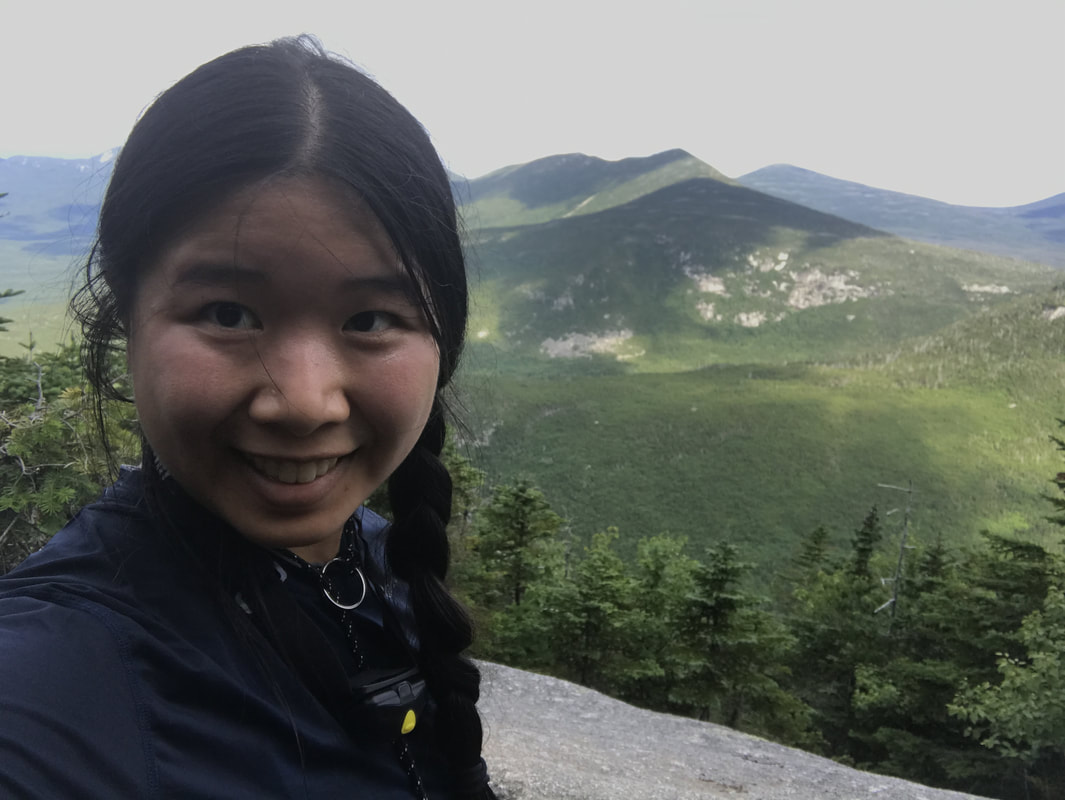
As I climb, the sky darkens. A steady drizzle begins. To my right is a peak - what looks like the summit. I can see a mile of the rock path up the mountain and the bright dots of dayhikers’ jackets as they stream up and down the path. Then, a sheath of fog rolls in, obscuring my view.
More and more people begin turning back as the rain continues. I pass a large group of girls, all around 10-12, putting on their rain jackets as their leaders tell them it’s time to abort their summit attempt. I look behind me and watch the last bright colored jacket disappear into the fog.
Suddenly, I am alone on the trail.
I waver for a moment, wondering whether I, too, should head back.
You didn’t come this far to turn back, a voice in the back of my head says. Besides, the weather report didn’t mention thunderstorms.
So, I keep going, step by shaky step, trying to ignore the uncomfortably high terrain.
Maybe it’s a good thing there’s fog. At least I can’t see too far down, I think.
I make my way up the peak. The terrain here is still rocky, but the boulders are considerably smaller.
The peak is a false summit. My GPS states that I still have 1.8 miles to go.
I find Phil, David, Anne, and Emma huddled against a boulder just over the peak.
“Is there any chance I could join you guys?” I ask. At this point, visibility is perhaps 20 ft, and I am half convinced I will die up here in a storm.
“Sure!” Anne says. “You don’t have to do this alone.”
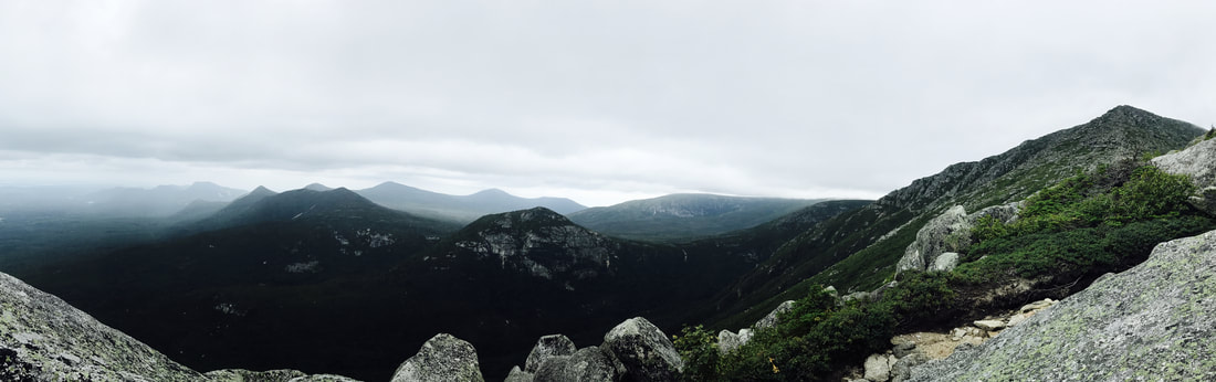
So, we push on together. Upwards to the Gateway, then the Tablelands, where the trail finally levels off.
The wind whips through our jackets. The air is damp and misty. The land seems barren and desolate.
This place is not meant for man, I think.
“Not the best day to do that monkey bar, hanging off a cliff, fearing for your life thing,” Phil remarks.
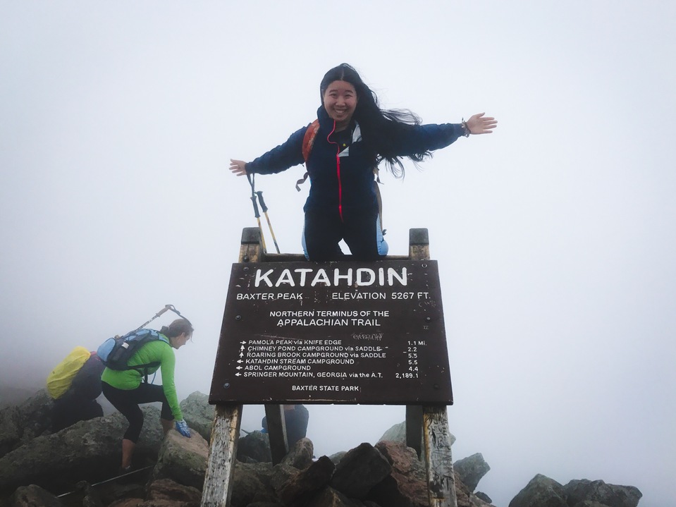
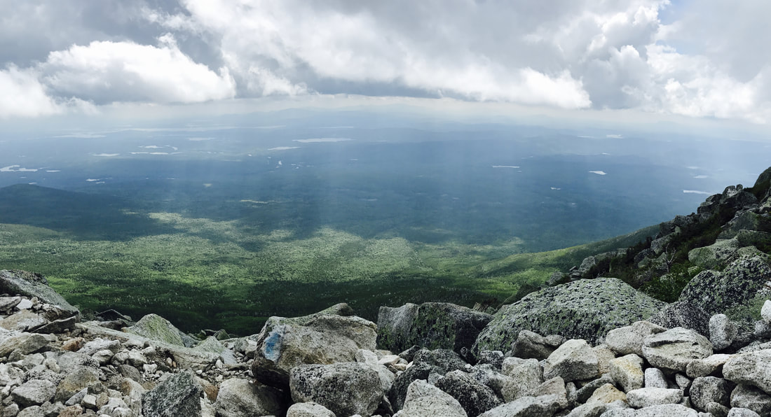
At 12:40 pm, we summit Katahdin. I climb onto the sign for the iconic picture, joy and terror vying within me.
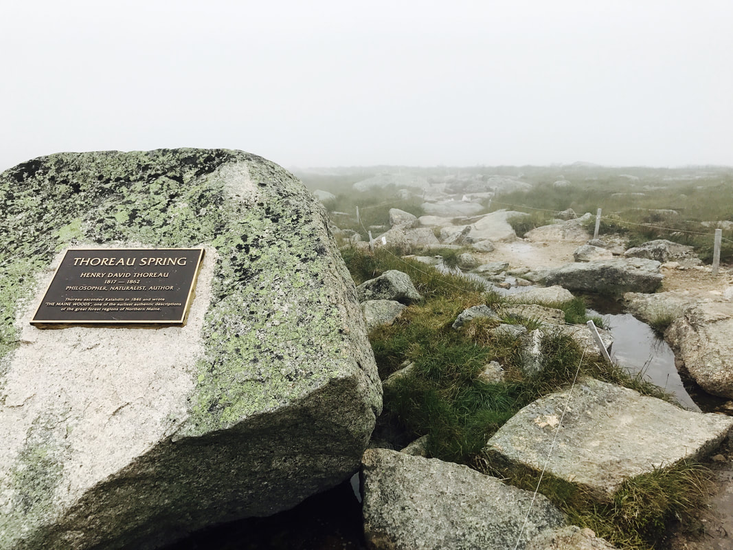
"And yet we have not seen pure Nature, unless we have seen her thus vast and dread and inhuman, though in the midst of cities. Nature was here something savage and awful, though beautiful. I looked with awe at the ground I trod on, to see what the Powers had made there, the form and fashion and material of their work. This was that Earth of which we have heard, made out of Chaos and Old Night. Here was no man's garden, but the unhandselled globe." - Thoreau, on Katahdin
"The worse the travel, the better the story." - David
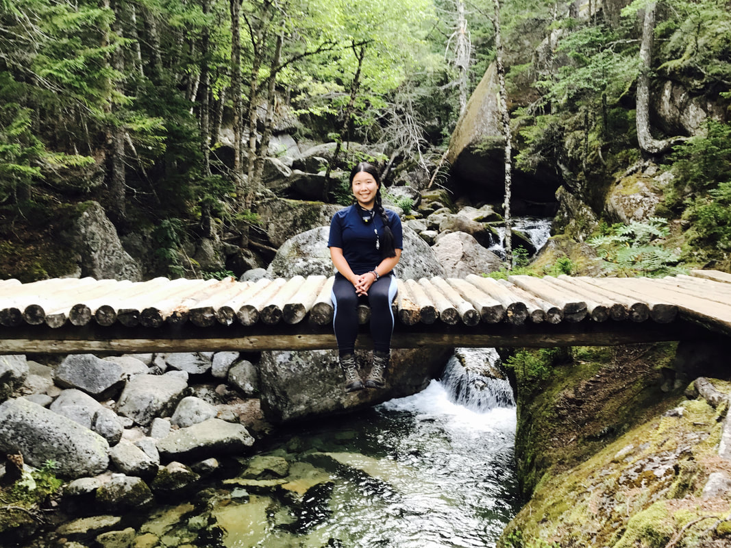
We descend via the Abol Trail, a trail so steep that for a couple miles, I can look back and see the peak straight above me. The trail follows the path of an old rock slide: a gray scar against the green mountainside. I inch my way down, often turning around to lower myself, or sliding down the vertical drops on my butt.
Somehow, I manage not to fall - not on the Hunt Trail, nor the vertical part of the Abol Trail - until we reach flatter terrain and I go off to take a bathroom break. On the way back, my feet slip out from under me, and I land flat on my back.
The Abol Trail emerges into a road 2 miles from Katahdin Stream Campground. A ranger drives past us in a truck as we begin our road walk. Anne nudges Phil.
Phil flags the truck down.
“You had a question?” the ranger, an older lady, says.
“So…is the, uh, shuttle back to the Katahdin Stream Campground running?”
The ranger laughs and agrees to give us a lift back to the campground. We arrive at 6:00 pm.
That evening, I listen to a ranger deliver a talk on all the fatalities that occurred in Baxter State Park, feeling rather glad to have safely summited Katahdin, and especially grateful for the family’s company.
*Days on trail, for simplicity